Maps
A Map for Everyone
The Woodlands has something to offer for every type of rider - pathway, on-road, off-road, and BMX.
Ready to ride? View our local ride calendar to ride with the community and our bike rack map for a place to park your bike.
Pathway Maps
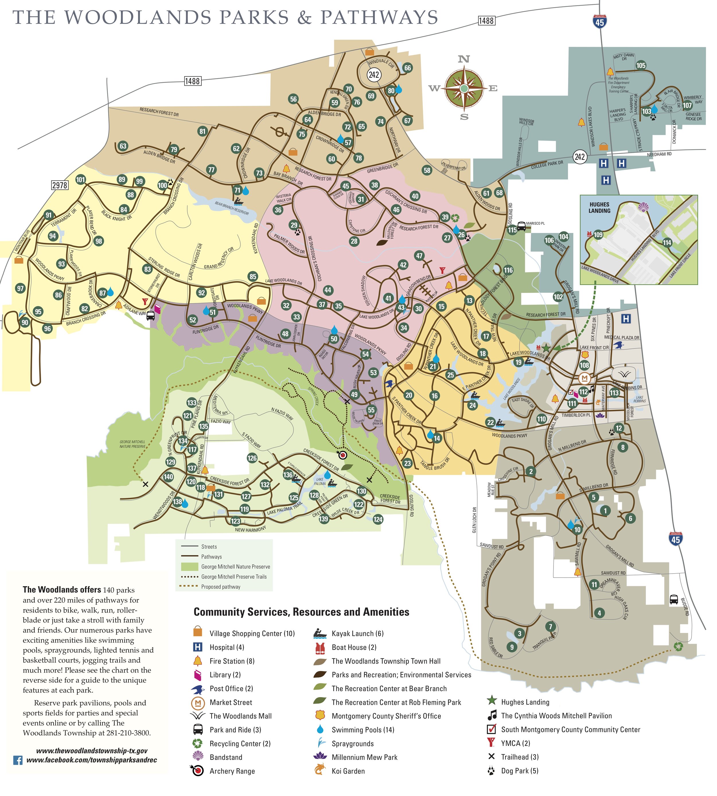
The Woodlands Township
Shared Pathways
The Woodlands Township has over 220 miles of multi-use paved pathways that are appropriate for riding at no more than 12 mph. Their pathway map is organized by the ten villages and employment centers. Major roads and parks are mapped. Check out the interactive map or PDF map.
For more details, visit The Woodlands Township.

Bike The Woodlands Coalition
Public Art Loops
Bike the Woodlands Coalition has mapped seven public art loops which feature 16 outdoor sculptures and 50+ parks, all connected by The Woodlands fabulous pathway system! These ride/walk/run loops cover most of the villages including Grogans Mill and Creekside.

Harris County Precinct 3
Spring Creek Greenway Trail
This 20 mile multi-use asphalted pathway is open to bikers riding no more than 15 mph. It currently extends from US-59 to 3 miles west of I-45, with additional plans to continue westward to George Mitchell Nature Preserve and Burroughs Park.
For more details, visit Harris County Precinct 3. For trail conditions, visit Facebook.
Bike The Woodlands Coalition
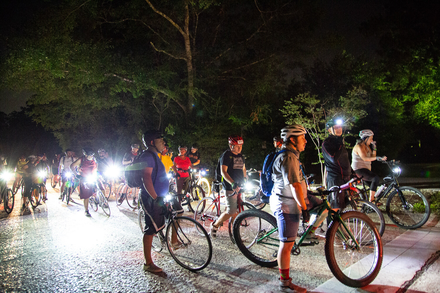
Family Bike Rides
In Fall 2022, Bike The Woodlands hosted a series of pathway rides geared toward riders of all ages and abilities. These pathway rides explored hidden parks, great fitness loops, and links to regional recreation sites throughout our community.
On-Road Maps
Roadway shoulders are a multi-purpose part of our roads which provide great places for people who ride bikes - great for transportation, for longer and faster rides, and for the safety of pathway users. Shoulders also make roads safer for motorists, provide for emergencies and emergency vehicles, and protect the roadway structure.

Bike The Woodlands Coalition
Roadway Shoulders
Bike The Woodlands Coalition surveyed over 31 miles of roadway shoulders in and around The Woodlands for width in 2017 and hazards in 2015.
Detailed shoulder hazard maps:
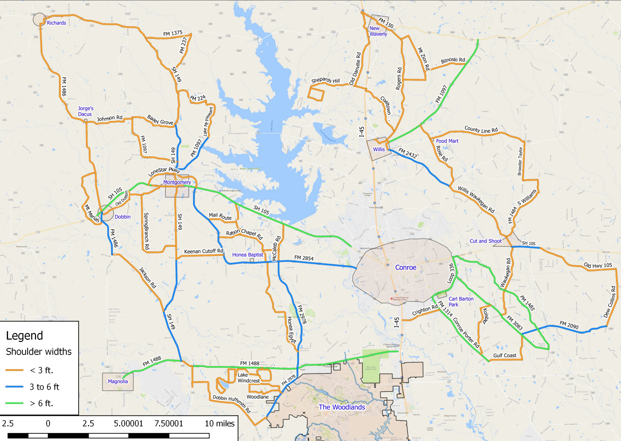
Bike The Woodlands Coalition
Montgomery County Routes
Bike The Woodlands Coalition developed this map for planning long-distance routes. They utilze the lower congestion rural roads of northern Montgomery County. The map includes shoulder widths to help you choose the safest route.
Off-Road Maps

GHORBA & The Woodlands Township
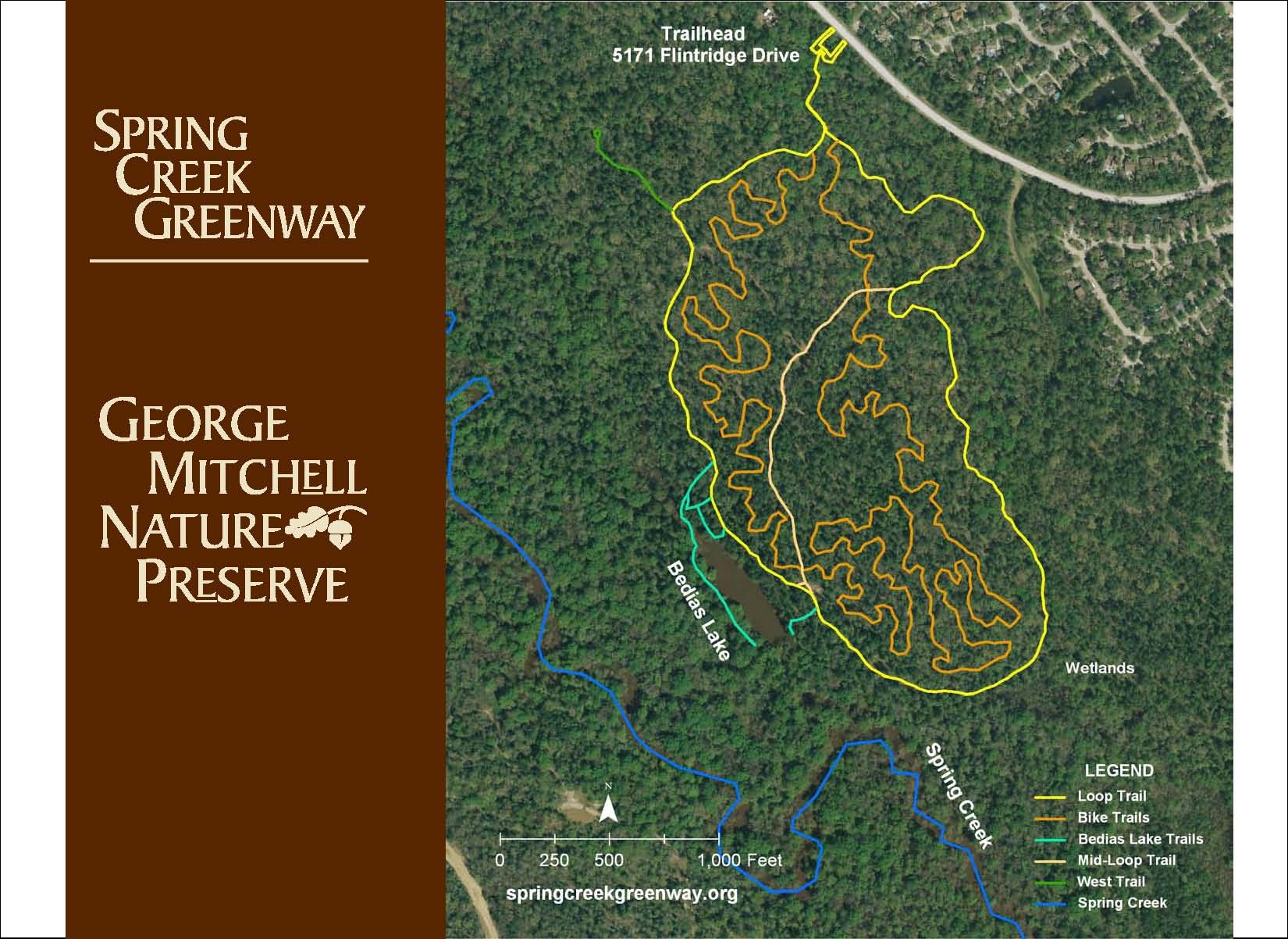
Flintridge
This 5+ mile natural-surface multi-use trail is located in the George Mitchell Nature Preserve. The inner loop is a tight and twisty single track exclusively for mountain bikers. Recent expansions take the trail east and west along the Spring Creek. Check out the GIS map, TrailForks, or picture map.
For more details, visit GHORBA. For trail conditions, visit Facebook.

Bayou Land Conservancy
Spring Creek Nature Trail
This 14 mile natural-surface multi-use trail follows Spring Creek and is open to mountain bikers.
The trail can be accessed in The Woodlands from several trailheads including Burroughs Park, Creekside Park West, Flintridge, Rob Fleming Recreation Center, and Montgomery County Preserve. Check out the GIS map, Eco-Tour, or PDF map.
For more details, visit Bayou Land Conservancy. For trail conditions, visit Facebook.

Texas A&M Forest Service
W.G. Jones State Forest
A combination of multi-use trails and pathways span nearly 15 miles within the forest and all are open to biking. The trail can be accessed on the north and south side of FM 1488.
For more details, visit Texas A&M Forest Service.
BMX Maps

The Woodlands Township
Bike Parks
There are nine wheel-friendly parks in The Woodlands open to BMX biking. These parks feature many fun ramps, banks, pipes, walls and jumps. Bear Branch and Harper’s Landing parks also feature bowls. Ridgewood and Cranebrook parks also feature a dirt pump track.
For more details, visit The Woodlands Township.

North Houston Development Company
Rockstar Bike Park
This is the largest bike park in the nation, so we had to mention it even though it is 14 miles south of The Woodlands. Spanning across 30 acres, it features concrete bowls, dirt jumps, pump tracks for all ages, and a flatland freestyle area.
For more details, visit Rockstar Energy Bike Park.
Other Maps
Google Maps
An interactive map that supports turn-by-turn navigation. It contains The Woodlands pathway system, bicycle friendly streets, and off-road dirt trails.
There are some trails missing from the map and it can be slow to include new trails so it is best as a supplement to the other maps linked on this page.
Regional Bikeway Viewer
The Houston-Galveston Area Council’s regional bike map covers several counties including The Woodlands.
The maps include a mapping layer of bicycle needs, primarily east/west on-road routes along Research Forest Drive and Lake Woodlands Drive. This is a complex mapping system with a wealth of information.